On climate justice: Prepare for extreme heat
Climate change and heat
Trends show the Minnesota climate is growing wetter and warmer. Daily low temperatures in southern Minnesota have increased 4.9 degrees since 1895. In addition to straining our environment, agricultural systems and economy, long periods of high heat and short periods of extreme heat can lead to heat related illness and even death.
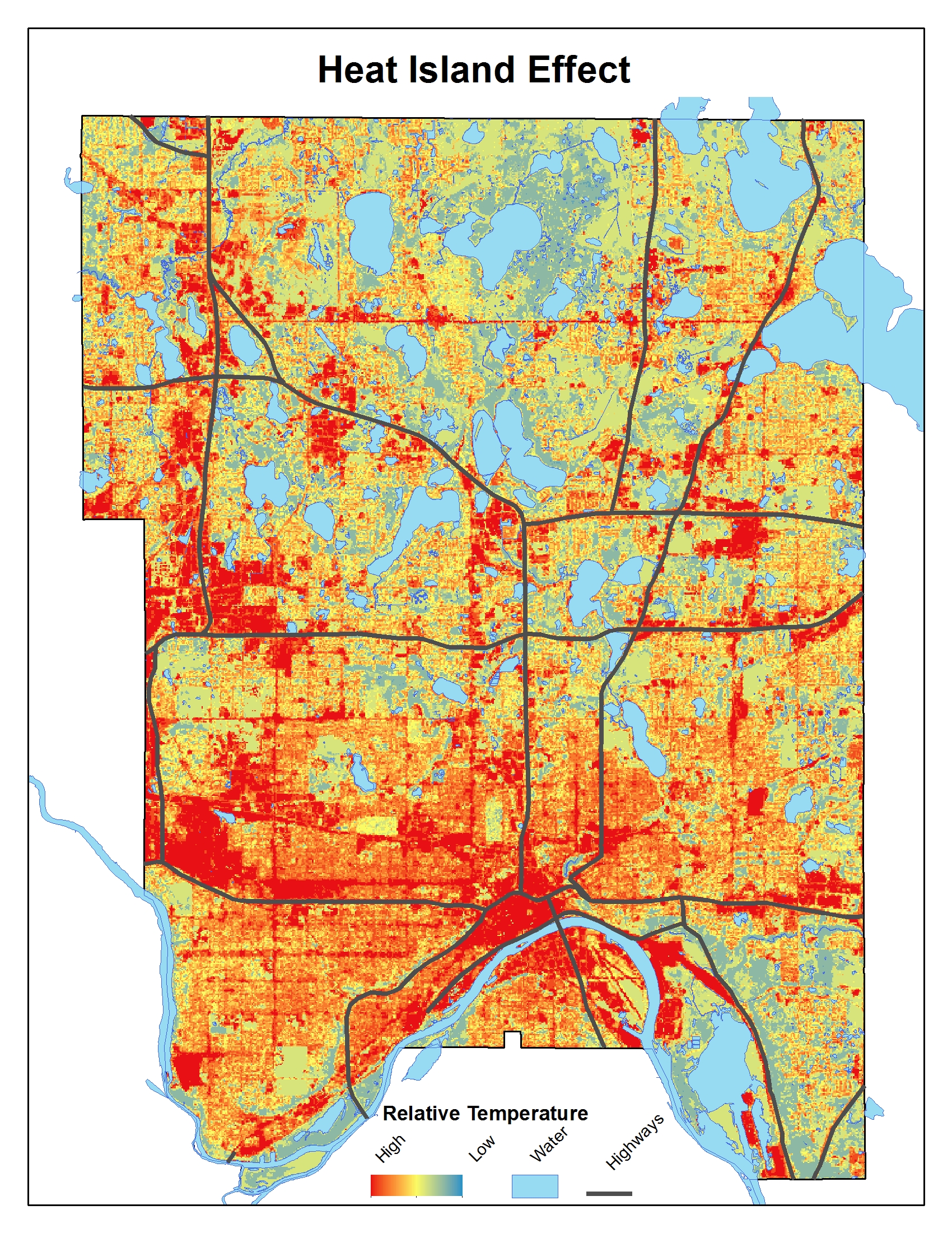
Urban heat island effect
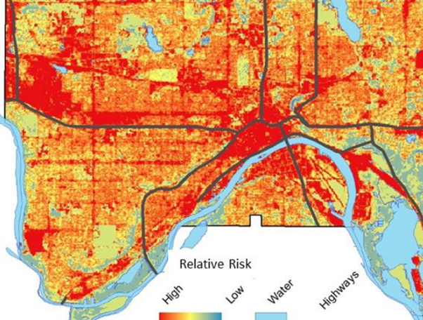
Portions of the county experience much higher temperatures than other areas because they have more concrete and asphalt surfaces, which absorb heat, and fewer trees or waterways, which have a cooling effect. This is called the "urban heat island effect" and has a significant impact on individual and community health. Portions of the county that experience the urban heat island effect today almost perfectly algin with neighborhoods that were historically devalued through zoning practices that discriminated against recent immigrants and residents of color.
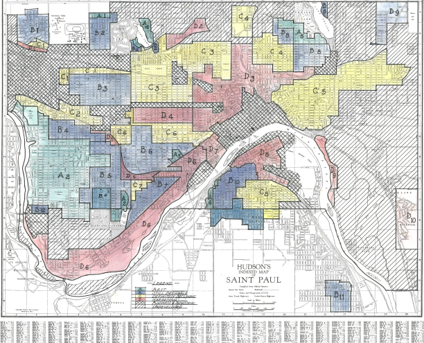
Areas shown in red on the map on the left were redlined. Areas shown in red on the map on the right are at higher risk of experiencing extreme heat today.
What you can do
While the county works to restore tree canopy on county land, you can learn about tree canopy needs in our region, become a tree steward to help maintain tree health in your neighborhood or plant climate smart trees on your property. Ramsey County Emergency Preparedness also provides a map of cooling spaces within the county and recommendations for staying cool in English, Español, Hmoob, Soomaali, Oromoo and Karen.